Archives

Finding time for Long-Form Writing and Other Pursuits.

Chloe Gilbert - 7 Jan, 2018

I’m finding that I’m doing the same these days. Twitter has become a torrent of noise and nobody seems to be really conversing these days. I had a lot of value out of early Twitter, and made some good friends as well as getting support for things like programming and events etc. Lately as you say it’s become useless. Facebook for me was always a way of keeping in touch with close friends and family, as well as getting support and organising events. But in the last few years it’s got worse and gone from a time sink to a toxic mess. I like blogs, they’re honest, you can make longer articles and people are guaranteed to see them if they want, and they’re longer lasting. Blogs will be around long after Facebook has gone away.

Finding time for Long-Form Writing and Other Pursuits.

Finding time for Long Form Writing

This morning I read twenty percent of a book whilst sitting in the car waiting for shops to open. In the process I occasionally looked up to see private jets and airlines fly over me. A few years ago in the same situation I would have been staring at my phone. I would have been refreshing twitter and Facebook looking for conversations. These days social media marketers and others are using social media as if they were Really Simple Syndication feeds, RSS. The problem with RSS feeds is that there a low signal to noise ratio. You need to skip hundreds of pieces of content for one or two worthwhile posts.

The Suunto Spartan Wrist HR

Suunto Spartan Wrist HR

My latest Suunto device is the Suunto Spartan Wrist Hr. This is a practical device that finally includes two features that I really wanted to see in a suunto device. The first of these is the Wrist heart rate monitor function and the second is a step counter that tracks physical effort on a daily basis and that can be reviewed later. [embed]https://www.instagram.com/p/BbouNhhnbAO/?hl=en&taken-by=richardazia[/embed]

Used for a multitude of sports.

I have used this device to track hikes, runs, indoor climbing, outdoor climbing, walks within cities and 7 minute workouts. Two of the devices strengths is that I no longer need to wear the heart rate monitor belt. This saves a few seconds and when you’re hiking or doing other activities with groups this is a nice feature. The second nice feature is that it detects GPS signals and provides a position within seconds. This means that you don’t need to wait or two like you needed to with the Suunto Ambit 3 and others.

A list of drones I have tried this year.

Trying various drones

This year I finally bought a few drones to play with and DJI and Hubsan are currently my favourite brands. The most fun to fly indoors is the Hubsan Nano Q111 drone, or something to that effect. At first this is a hard and temperamental little drone to fly. Just getting it off the ground is a challenge., This challenge comes from the fact that it has no pilot assistance. It slews to the right and the left and it has no altitude hold. This means that constant little inputs are needed. As the battery depletes you need to give the drone more power simply to hover. With practice the drone is really fun and best of all I didn’t break any props. I only burned out two of the motors when the drone got caught in something. I tried flying the Q4 as well but the results were disappointing. I tried flying the Demon something by some brand and this was a flop. The problem with this drone is that the props are well protected against colliding with things but the struts are too fragile. Within just a flight or two I broke the strut to one of the props and it is now great at spinning in place rather than flying.

Flying the DJI Spark is fun

My most recent flight with the DJI Spark was fun. As I forgot the miniSD card I decided just to fly it in sports mode over some empty fields. I ended up flying over 4km within visual range. It was fast, responsive and behaved just as I wanted it to.

Indoor flying

Flying the drone indoors is possible. Thanks to its downward facing cameras and proximity sensors it detects when it flies too close to objects and stops. It does have the weakness that if it detects objects below it or objects ahead of it it will back and rise. As it has no upward looking sensors and no sensors looking behind or to the sides the risk of collisions increases. For these reasons flying indoors is more demanding. It also displaces a large volume of air. It will shift light objects so be careful what you fly over.

The Hubsan Nano Q4 H111 drone

The Hubsan Nano Q4 H111 drone is a tiny drone

The Hubsan Nano Q4 H111 drone is a tiny drone. It is not much more than a flying circuit board with four engines, a battery and a cowling. It is very light and fits easily on the screen of an iphone SE, along with it’s controller. Such a small drone requires practice to fly properly. This is because there are no flight assists. When you take off you need to apply just the right amount of thrust to hover and you need to make small adjustments to keep it from drifting. With practice you gain control of the quadcopter.

From Grächen to Zermatt via the longest suspension bridge: part two

From Grächen to Zermatt via the longest suspension bridge: part two

  [gallery ids=“3755,3756,3757,3758,3759,3760”] When you wake up in the Europahütte and look down you can see the span of the longest suspension bridge in the morning shade of the mountains. It’s at this moment that people like me think “shame, not ideal for pictures”. My advice is to plan the day of hiking so that you arrive at the bridge when it’s lit by the sun to get good images. Plan to arrive in the afternoon. I’d be tempted to start from Zermatt if I did this hike again.

From Grächen to Zermatt via the longest suspension bridge: part one

Hiking from Grächen to Zermatt via the longest Suspension bridge is an interesting two-day hike. It provides you with views of glaciers, boulder fields, scree slopes and more. It also provides you with the opportunity to cross a suspension bridge that takes six minutes.

Hiking up from Grächen

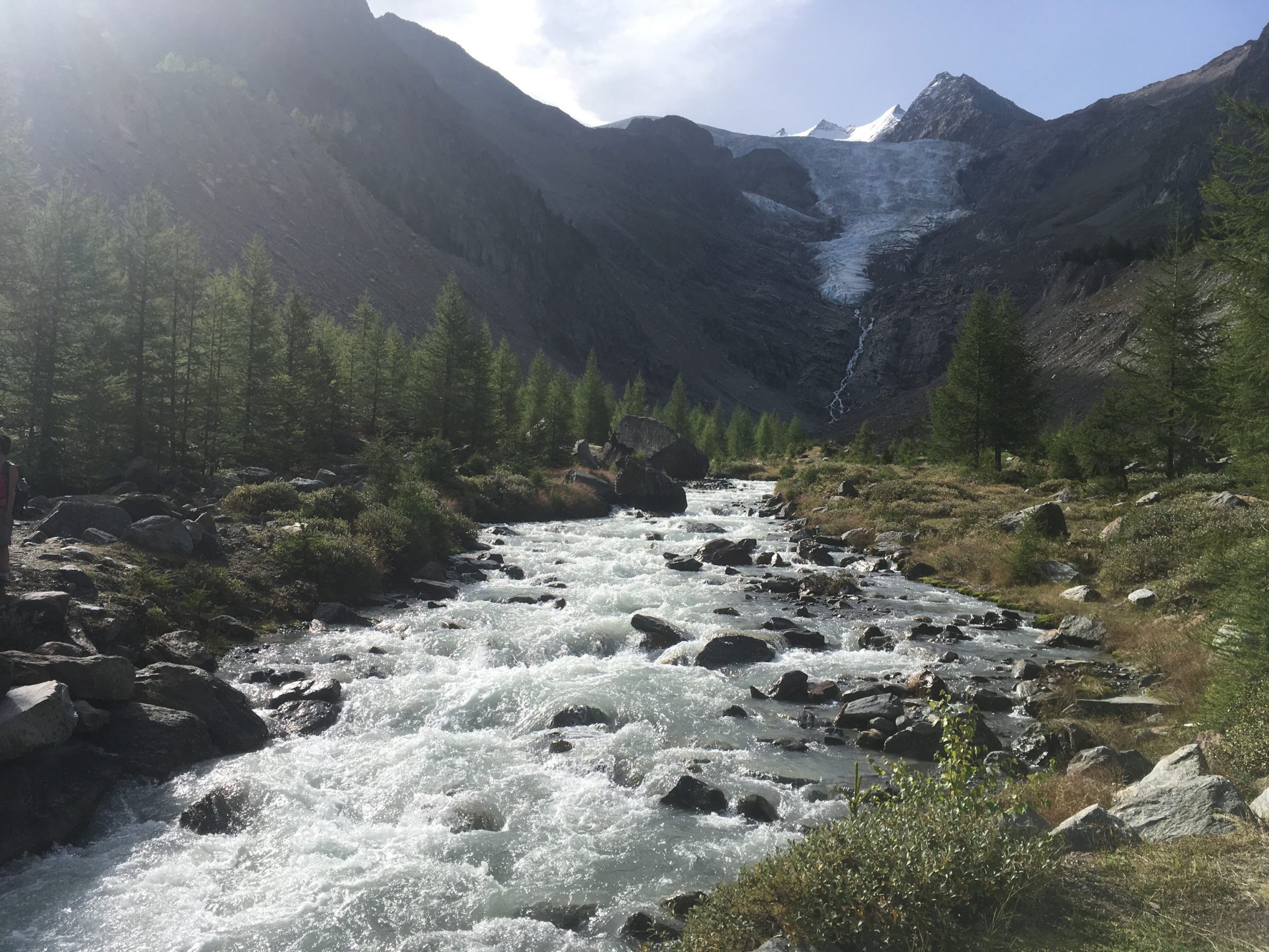
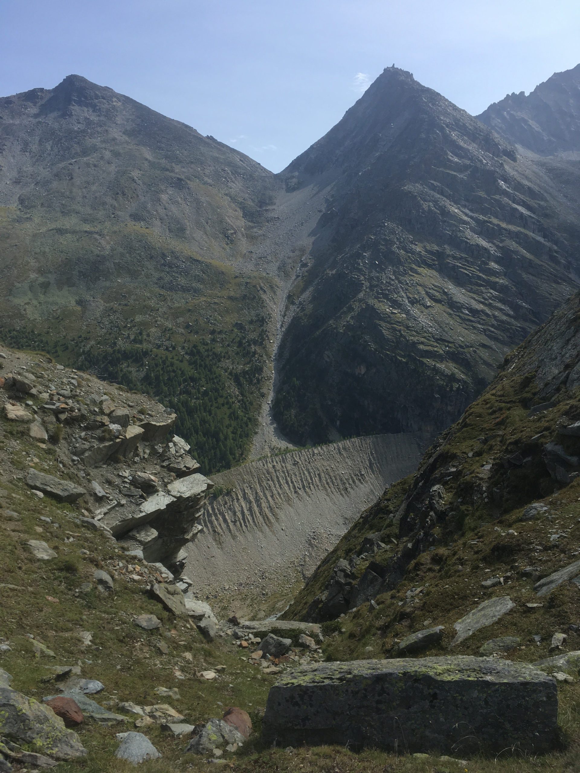
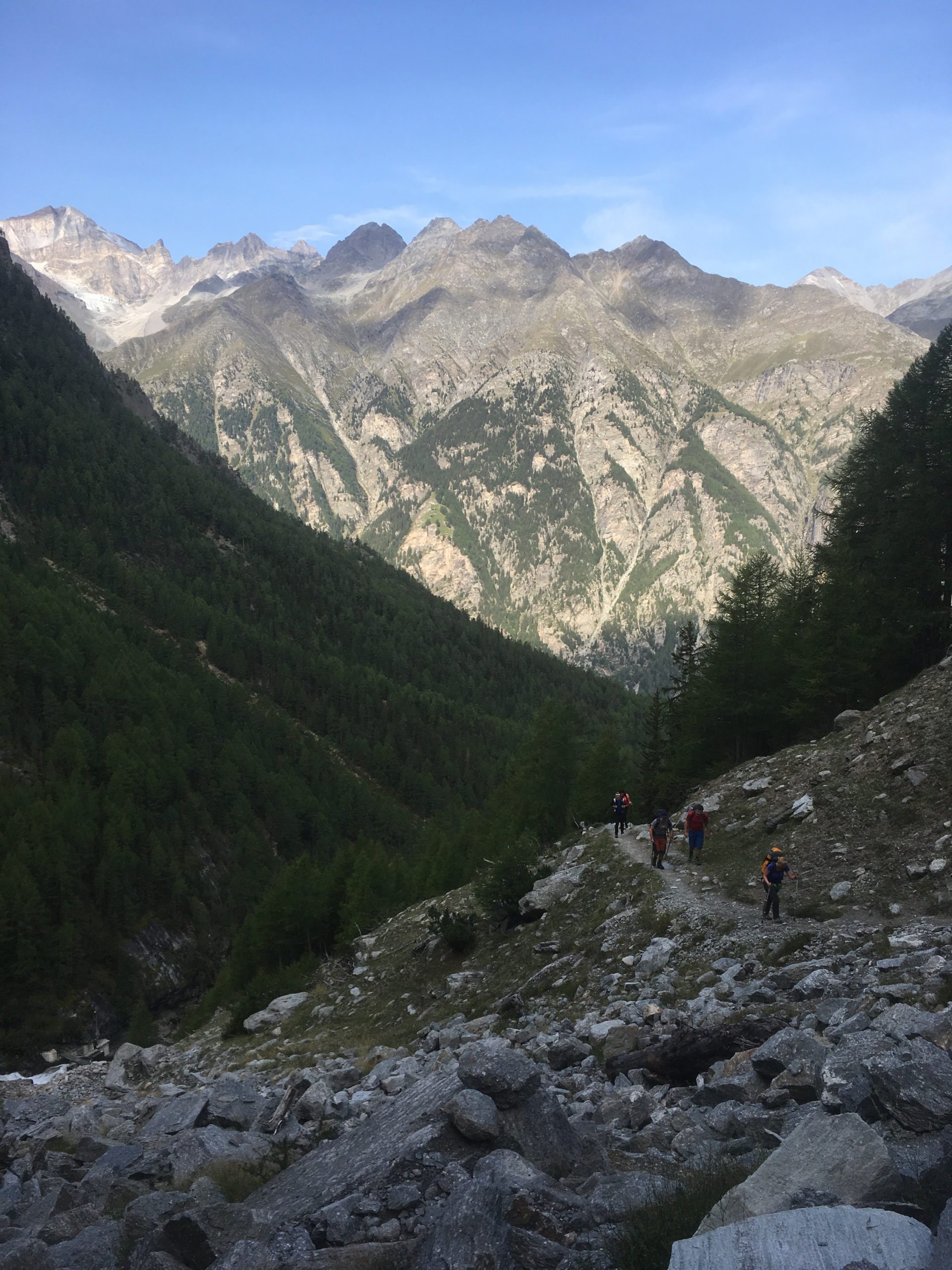
The hike up from Grächen takes you up through a forest. You go through a forest and there is a stream to your left and the nice landscape to your right. The hike up is easy. [caption id=“attachment_3736” align=“aligncenter” width=“768”] Path that leads up to a first view of a glacier[/caption] As I hike with a water filter I like to get water straight from glaciers when I can. I gathered water from the glacier. It tastes good and it’s fresh. Gathering water from this point is easy. [caption id=“attachment_3737” align=“aligncenter” width=“1024”] A nice Cirque[/caption] From this cirque you climb up through some more trees and eventually you get to a nice view point from which you can see the landscape. This provides a good point for a snack and rest. [vrview img=“https://www.main-vision.com/richard/blog/wp-content/uploads/2017/08/export_1503909534859.jpg” width=“500” height=“500” ] Use mouse to look around image above. (360 image) [caption id=“attachment_3738” align=“aligncenter” width=“768”] You can clearly see evidence of where the glacier was.[/caption] Many years ago the glacier reached down into the valley below. You can clearly see the depth of the former glacier. At this point you are above the tree line. You begin to walk on bare rock. The slopes get steeper and you are more exposed. [gallery ids=“3741,3740,3739”] One segment of this hike crosses a zone of active rock falls. When we were walking here we heard a loud noise that sounded like thunder or a jet. After a few seconds we saw large rocks falling down the slope and bouncing. Where they hit the ground clouds of dirt and dust erupted. It was too far away for me to get good video footage. At this moment we were more attentive. If you look up you see that massive rocks get loose and fall. Look at the contrast between the sign post and the boulders. You need to scramble and climb over rocks and navigate your way towards safety. [gallery ids=“3742,3743”]

Caught in a hailstorm 200 meters from the peak

A few days ago a group of us were caught in a hailstorm 200 metres from the peak. When we were approaching the summit we aimed to climb clouds came in and covered the peak and rain fell. At this moment we had doubts about going on. Half an hour later the clouds had gone, we could see the summit and so we started for the summit. As we climbed up the conditions were good. There was a strong wind As we got within two-three hundred metres from the top the wind picked up and we could hear lightning several seconds away. At this point, we slowed our climb. [gallery ids=“3725,3726,3728”] As I looked behind I could see the clouds coming in fast and as I looked the other way I could see the clouds come that way too. By this point the wind was strong and the sky became dark with the clouds we were in. It started to rain and then hail. At first, it was a few very small hailstones but within a minute or two they became large enough to become painful through a cap and a rain jacket hood. We sheltered against rocks to minimise what was exposed to the weather. The intensity of the hail increased and as I started to feel pain I hitched my hiking bag over my head, shielding as much as I could beneath it. As I did this I looked out and it looked like someone was throwing buckets of hailstones. I could feel my trousers getting drenched and my hands got very cold. The wind shifted and the hailstones started to pummel my back and I stayed sheltered. It was an uncomfortable situation to be in. Water was running from my trousers into my shoes and my feet were soaked. When the hail started to subside I stood up and we started to head down. I looked up. One person from the group was rushing down and I decided to descend as well for a bit. I couldn’t see the person who was leading the group so I decided to wait. The storm seemed to have passed and I chose to wait. When he came down I blew into my hands vigorously, warming them up again. Diving in cold lakes I grew used to having cold hands so I did what I always did. I warmed them up again. This was a mild cold. After some dives, I had such cold hands that they hurt so badly that I was close to tears. In this scenario, I was just uncomfortable. The surface was white with hailstones, as if it had just snowed. The leader did come down, smiling. By this point it was an adventure. The concern we had from being in such a situation became amusement at having experienced extreme weather. It’s the first time that we had been caught in a hail stone after years of hiking in the mountains. I almost always carry my rain equipment when I’m hiking for just such an occurrence but usually, it’s just weight that I carry in case it is required.
Your own Waze driving directions

Your own Waze driving directions

You can now record your own Waze driving directions. Instead of using pre-determined voices you can record a number of pre-determined phrases and use them for when you are driving. Recording and using your recording is easy.

Setting it up

In the settings menu go to voice directions, click on record new voice, name the voice and then you can record Start of Drive messages, Distances, Instructions, Reports and Other. Each instruction can be up to 6 seconds in duration. Simply click the red record button, record the phrase and then listen to it. Once you have recorded the first clip you can save the new voice.