Swiss Walks

Summer without a car has taught me to live locally

This summer I was thinking of buying a car until I found out that my contract break was for six months rather than three. As a result of this my ability to buy my own car vanished. I used the scooter, my feet and eventually the bike to travel thousands of kilometres. 

I rode the scooter for at least four thousand kilometres and I cycled for around 1000km. I also hiked 

Walking from Nyon to St Cergue

When I neared the top of the Jura I walked through part of the forest where the smell of pines was strong. I usually associate that smell with hikes further afield and at higher altitudes. It was nice to find it so close to home. To do this walk you can set off from Nyon Train station and follow the signs with the number 5 for the Chemin des Crêtes Du Jura

From Grächen to Zermatt via the longest suspension bridge: part two

From Grächen to Zermatt via the longest suspension bridge: part two

  [gallery ids=“3755,3756,3757,3758,3759,3760”] When you wake up in the Europahütte and look down you can see the span of the longest suspension bridge in the morning shade of the mountains. It’s at this moment that people like me think “shame, not ideal for pictures”. My advice is to plan the day of hiking so that you arrive at the bridge when it’s lit by the sun to get good images. Plan to arrive in the afternoon. I’d be tempted to start from Zermatt if I did this hike again.

From Grächen to Zermatt via the longest suspension bridge: part one

Hiking from Grächen to Zermatt via the longest Suspension bridge is an interesting two-day hike. It provides you with views of glaciers, boulder fields, scree slopes and more. It also provides you with the opportunity to cross a suspension bridge that takes six minutes.

Hiking up from Grächen

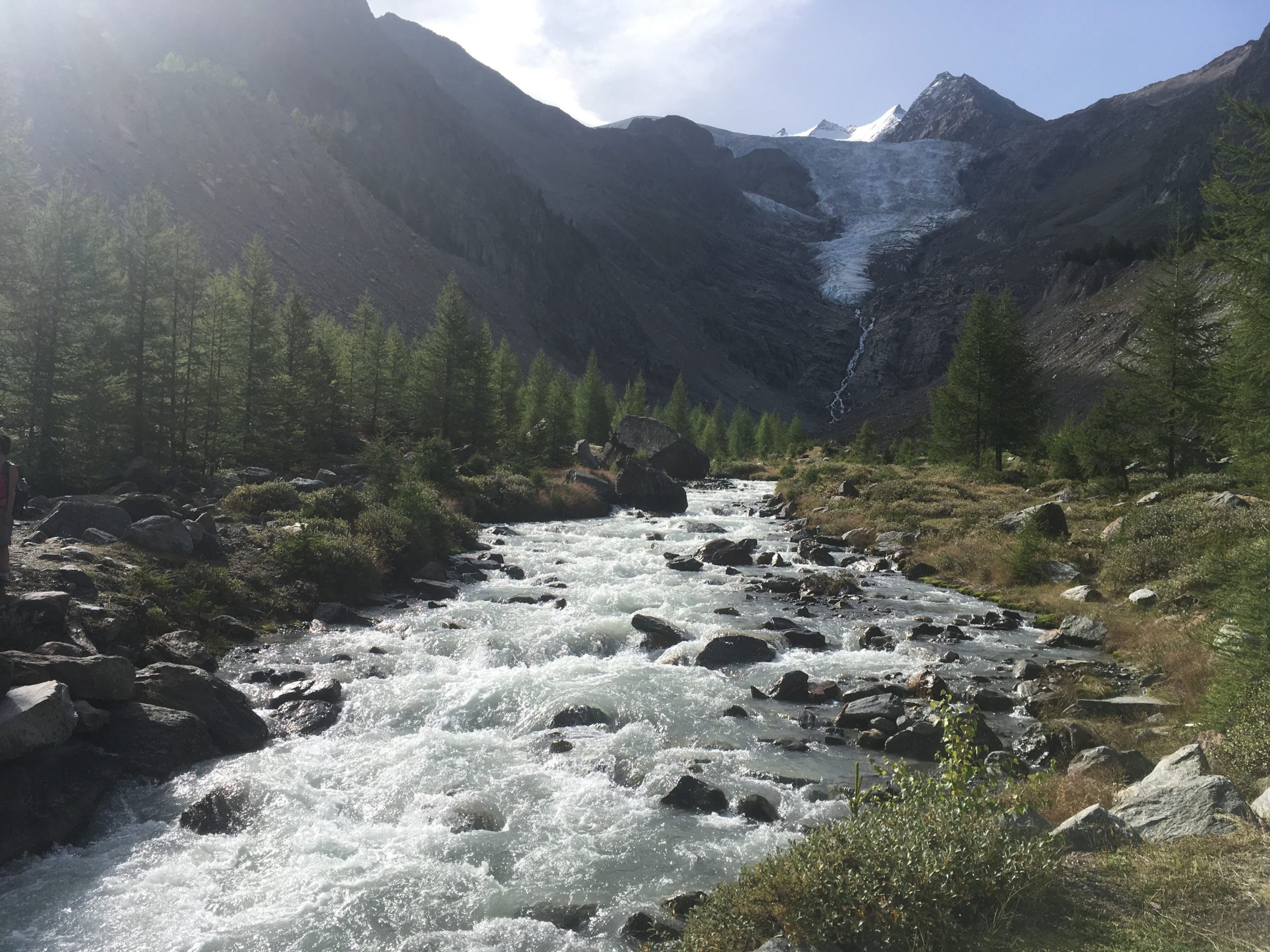
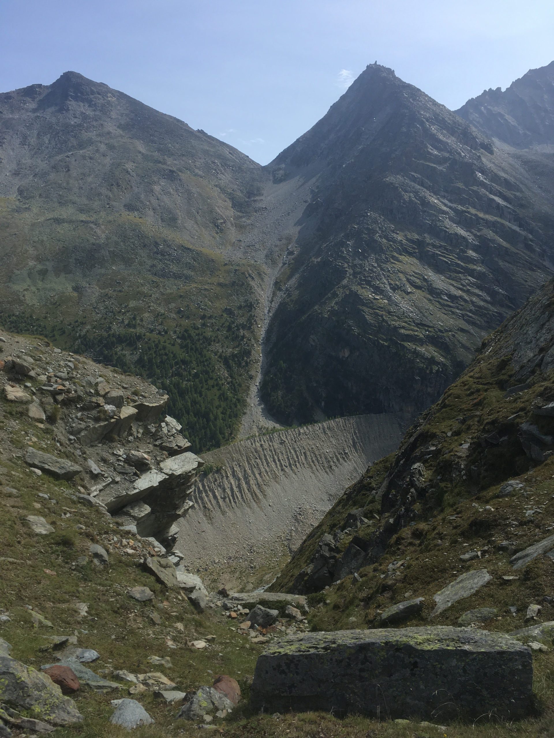
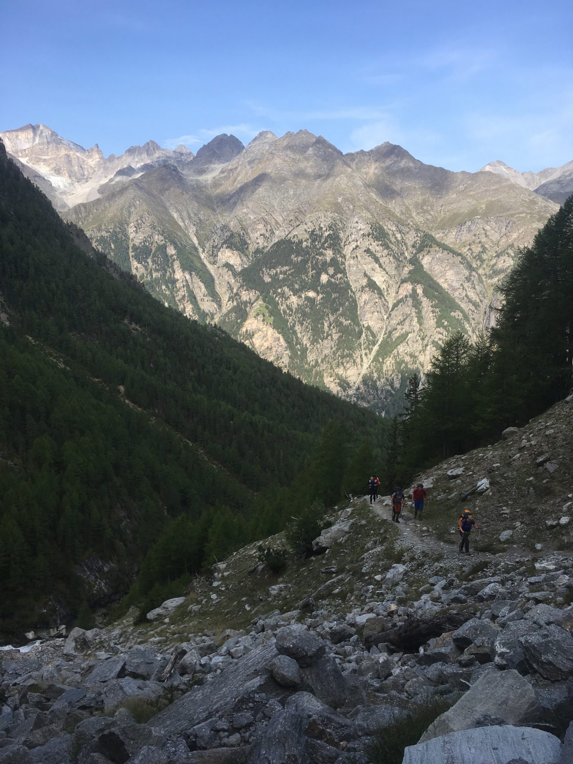
The hike up from Grächen takes you up through a forest. You go through a forest and there is a stream to your left and the nice landscape to your right. The hike up is easy. [caption id=“attachment_3736” align=“aligncenter” width=“768”] Path that leads up to a first view of a glacier[/caption] As I hike with a water filter I like to get water straight from glaciers when I can. I gathered water from the glacier. It tastes good and it’s fresh. Gathering water from this point is easy. [caption id=“attachment_3737” align=“aligncenter” width=“1024”] A nice Cirque[/caption] From this cirque you climb up through some more trees and eventually you get to a nice view point from which you can see the landscape. This provides a good point for a snack and rest. [vrview img=“https://www.main-vision.com/richard/blog/wp-content/uploads/2017/08/export_1503909534859.jpg” width=“500” height=“500” ] Use mouse to look around image above. (360 image) [caption id=“attachment_3738” align=“aligncenter” width=“768”] You can clearly see evidence of where the glacier was.[/caption] Many years ago the glacier reached down into the valley below. You can clearly see the depth of the former glacier. At this point you are above the tree line. You begin to walk on bare rock. The slopes get steeper and you are more exposed. [gallery ids=“3741,3740,3739”] One segment of this hike crosses a zone of active rock falls. When we were walking here we heard a loud noise that sounded like thunder or a jet. After a few seconds we saw large rocks falling down the slope and bouncing. Where they hit the ground clouds of dirt and dust erupted. It was too far away for me to get good video footage. At this moment we were more attentive. If you look up you see that massive rocks get loose and fall. Look at the contrast between the sign post and the boulders. You need to scramble and climb over rocks and navigate your way towards safety. [gallery ids=“3742,3743”]

Caught in a hailstorm 200 meters from the peak

A few days ago a group of us were caught in a hailstorm 200 metres from the peak. When we were approaching the summit we aimed to climb clouds came in and covered the peak and rain fell. At this moment we had doubts about going on. Half an hour later the clouds had gone, we could see the summit and so we started for the summit. As we climbed up the conditions were good. There was a strong wind As we got within two-three hundred metres from the top the wind picked up and we could hear lightning several seconds away. At this point, we slowed our climb. [gallery ids=“3725,3726,3728”] As I looked behind I could see the clouds coming in fast and as I looked the other way I could see the clouds come that way too. By this point the wind was strong and the sky became dark with the clouds we were in. It started to rain and then hail. At first, it was a few very small hailstones but within a minute or two they became large enough to become painful through a cap and a rain jacket hood. We sheltered against rocks to minimise what was exposed to the weather. The intensity of the hail increased and as I started to feel pain I hitched my hiking bag over my head, shielding as much as I could beneath it. As I did this I looked out and it looked like someone was throwing buckets of hailstones. I could feel my trousers getting drenched and my hands got very cold. The wind shifted and the hailstones started to pummel my back and I stayed sheltered. It was an uncomfortable situation to be in. Water was running from my trousers into my shoes and my feet were soaked. When the hail started to subside I stood up and we started to head down. I looked up. One person from the group was rushing down and I decided to descend as well for a bit. I couldn’t see the person who was leading the group so I decided to wait. The storm seemed to have passed and I chose to wait. When he came down I blew into my hands vigorously, warming them up again. Diving in cold lakes I grew used to having cold hands so I did what I always did. I warmed them up again. This was a mild cold. After some dives, I had such cold hands that they hurt so badly that I was close to tears. In this scenario, I was just uncomfortable. The surface was white with hailstones, as if it had just snowed. The leader did come down, smiling. By this point it was an adventure. The concern we had from being in such a situation became amusement at having experienced extreme weather. It’s the first time that we had been caught in a hail stone after years of hiking in the mountains. I almost always carry my rain equipment when I’m hiking for just such an occurrence but usually, it’s just weight that I carry in case it is required.
Day 2 - Villars-sur-Ollon to Le Sepey

Hiking from Villars-sur-Ollon to Le Sepey

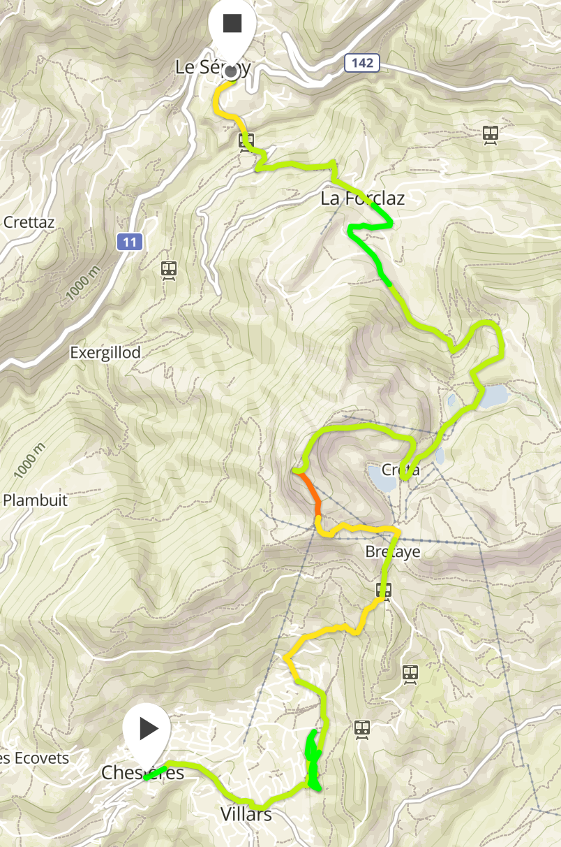
On the second day we hiked up from Villars Sur Ollon to Le Chamossaire. The trail is easy to follow. When you exit the town it takes you through some woods before emerging on to a prairie. From this prairie you have a nice view of the landscape. From here we progressed laterally to the next wooded part. We crossed some fields filled with flowers. Some parts of this trail are muddy so hiking boots simplify the effort. We also crossed a prairie where cow hoofs had churned up the mud. [gallery columns=“2” ids=“3663,3664,3665,3666,3667,3668,3670”]

Day 1: Hiking from Gryon to Villars Sur Ollon.

First evening

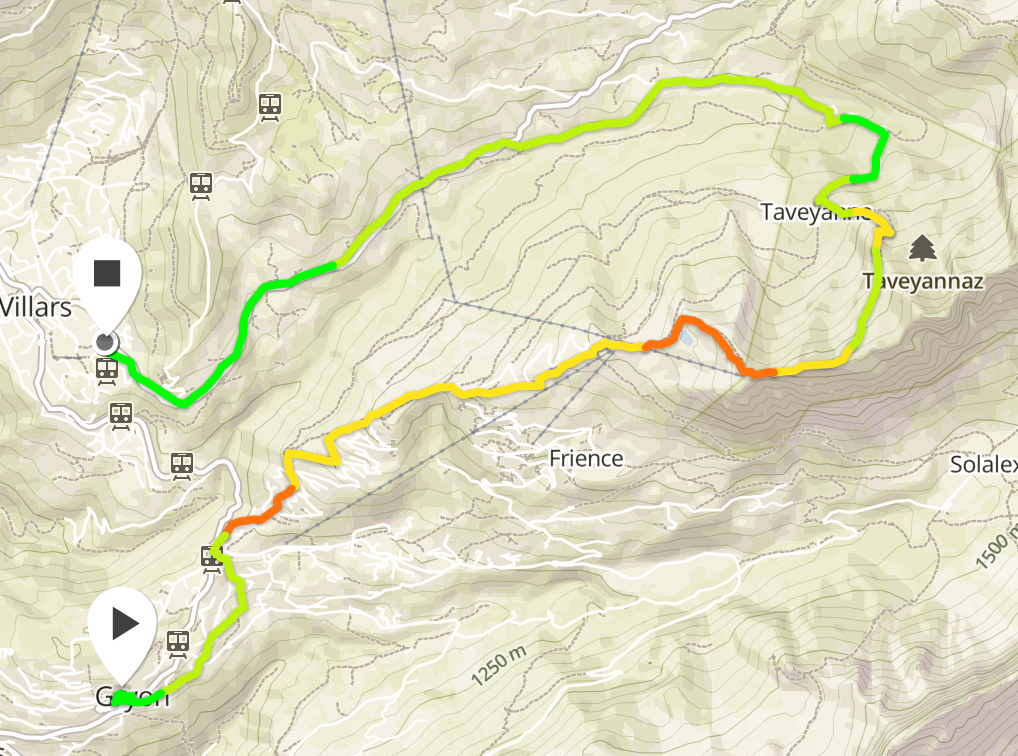
This weekend I went on a two day hike. It was a combination of a Summit Foundation themed hike and a Wehike event. The hike was over two days and two nights. We arrived on Gryon on Friday night and stayed at the Chalet Martin. This is a nice relaxed backpacker hostel with a trampoline, bunkbed rooms, optional breakfast and more. It is located within easy walking distance of the train station and is easy to find. I slept well.

Clean Water for Hikes and cycling, without the weight

Clean water is important to have when you’re cycling, hiking or climbing in summer but the issue is that it is heavy. When I go cycling I go with just one flask and I fill up the water bottle when I get to fountains that are marked as safe to drink from. When I go hiking or climbing I usually do not go with more than one and a half litres of water although I have gone with up to three litres for a hot summer day’s activities when the temperature is above 32°c. In Switzerland, France and Italy you theoretically do not need to walk with that much water because you cross streams, fountains, rivers and lakes. If you had a water filtration system you could theoretically purify the water from these sources and continue hiking. Yesterday I came across Katadyn and two solutions for water filtration.

My first Wehike Hike

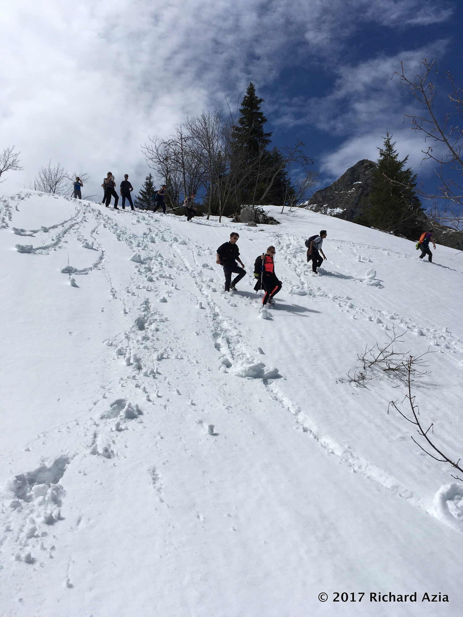
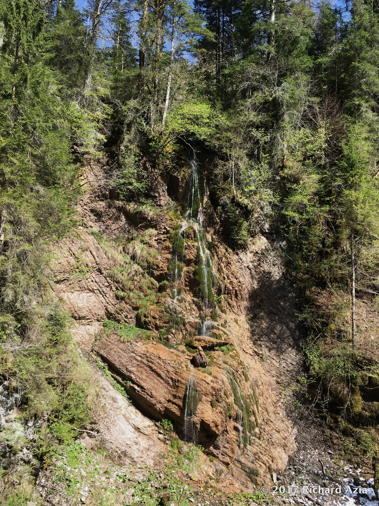
Wehike is a website dedicated to find people with whom to hike. People can contribute hikes to wehike and then they or other people can organise events based on the hike information. This includes a GPX file and images. At the moment this site is in beta so they are looking for user feedback. At the moment they are based in Switzerland but they will be able to expand globally as people contribute hikes and other people participate in these hikes. I liked yesterday’s hike because for once I was struggling to keep up with the group rather than the opposite. Usually I’m leading the group and stopping every so often to take pictures and because I’m not certain of which fork to take next. In this case they were waiting for me. This is in part due to the Via Ferrata de Saillon trip the day before. I’ll get back to being in front of the group and taking pictures soon. This hike was interesting because winter is not over. Apparently twenty five centimetres of snow fell the day before. As a result one local recommended that we choose another route than the one we had planned on. We decided instead to see how the conditions were. As is the case when you go for hikes in Spring the damage from winter has not being cleared away. We found trees and branches on the paths and paths that would normally be clear to find required more instinct and orientation than average. When you start heading up properly you walk straight up through a pasture and you get to a stone ruin. We stopped at the ruin for a snack/lunch. From this point you walk up steep paths near the field’s age with a river to your right until you get to a clearing. From the clearing you walk up some more and you get towards the vista below. This is a view looking North at a steep climb up. If you continue to the Cap au Moine then you still have some climbing to do. Due to the deep snow and conditions this is the point at which we started heading back down. We walked along in 20-30 centimetre snow falling someone’s snowshoe traces and then headed down. When the snow is deep and powdery like it was yesterday it’s really fun. You can run and jump down the hill. I would share the photos if I had the participants’ permission. Here’s a taste. If you look at my GPS trace you will see how fast we were descending the slope. Eventually you get back to the grass and the tree line. When you get back down to the river you cross a stone bridge and to the right you see a waterfall pictured below. I enjoyed this Wehike because we had the opportunity to navigate and find the route, we got to climb over trees and walk under branches. We also got to walk a steep hill in the snow and run and bound down a snowy slope without worrying. Snow is so much softer for the knees. I would like to redo the hike later in the season when the snow has gone.

The SUUNTO SPARTAN SPORT WRIST HR BLUE

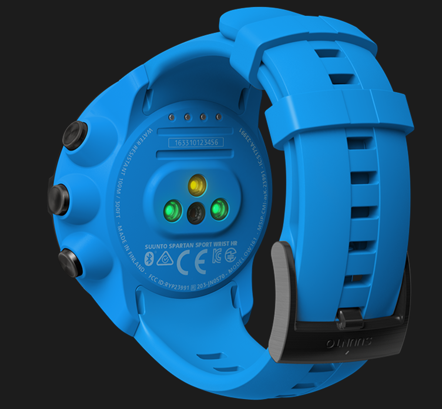
I have logged 799 activities with my Suunto devices. This includes hikes, via ferrata, climbing, swimming and scuba diving. I like Suunto devices because their battery life is good enough to last through entire days of hiking and the battery lasts for weeks between charges when used as a simple watch. Spartan HR I like to track my heart rate but I often feel self conscious about putting the heart rate monitor belt on. With the latest Spartan watch I no longer need to worry about the belt. At the same time as I start the activity I will be able to keep track of the heart rate. This is especially good for group activities when you do not want to keep people waiting and in winter when you’re wearing layers of clothing. I like that devices like the Fitbit Charge 2 can be worn at almost all times and track heart rate effortlessly when at the climbing gym and during other activities. I look forward to the same simplicity with a Suunto device. I especially like that Suunto devices survive swims and showers. I like that the Suunto Ambit 3 tracks how many steps I take during the day. It’s a shame that the step count is not logged and visible on Movescount. I like to see how energetic or lazy I have been on a daily, weekly, monthly and yearly basis. It’s not unusual for me to go from a 21,000 step day to a 6000 step day. It depends on weather, work and other factors. If you go for a bike ride your step count will not be high. I will wait to see whether they apply this technology to the Suunto Ambit watch collection. If they come out with the Suunto Ambit 4 Wrist HR then I will be tempted to upgrade. With 799 tracked activities I believe Suunto devices have demonstrated that they are reliable.