Archives

The Fitbit Charge HR

The Fitbit Charge HR is one of the better heart rate and step counting solutions out at the moment. It allows you to keep track of your steps and heart rate twenty four hours a day for a little less than a week between charges. It is a wrist worn activity tracker that detects whether you are walking, running or climbing up a hill. I tested it over a period of weeks while hiking, doing via ferrata, cycling and sleeping. As a result of the test environment I was informed by the device that I had gone up 250+ floors in a single day. That’s when I was playing on a via ferrata or two. I also tested it while I was sleeping. It automatically goes in to sleep mode so there is no chance of you forgetting. As it tracked my heart rate while I was sleeping I saw that my resting heart rate could be 47 beats per minute. As I challenged myself with a 1000m hill climb on a bike followed by via ferrata and hiking my body became fatigued and this was reflected in my higher resting heart rate. It went up by four or five heart beats per minute. When I was using the Fitbit Charge HR I had it automatically tracking my heart rate but you can choose whether it is on/off or automatic. I kept it on automatic. When you take off the tracker the two green led lights stop blinking automatically after a few seconds. I liked having the Fitbit Charge HR for a few weeks and liked that it tracked my heart rate and showed me how many floors I went up. As I spend a lot of time in the mountains though the results were skewed. The biggest weakness with the Fitbit Charge HR has to do with the regionalisation efforts by Fitbit. I live in Switzerland and until recently I had the site in English. For a few weeks I have had to switch languages between french and English several times. I wrote a tweet to get a response but they asked me to send an e-mail. I sent an e-mail detailing the problem and then they asked me to detail what the problem was. The problem is that I am in the French speaking part of Switzerland, my laptop and phone are set to English and the app and website default to German. Due to their regionalisation efforts when I sold the device as planned I did not replace it and went back to using the Fitbit flex. As both straps for the Fitbit flex broke I carry the sensor in my pocket. As a point of reference my primary fitness tracker is the Suunto Ambit 3. When I cycle, swim, do via ferratas or hike that is the device that is tracking my progress and overall fitness level. I also pair it with Strava.
Tudor Monastery Farm - A documentary series

I took advantage of a rainy day to watch a series of documentaries by the BBC called Tudor Monastery Farm. It is a documentary series where three individuals live the life people would have lived at the relevant time period for a year. During this year they try farming, mining, fishing and other skills and crafts from the time. These are observational and experimental documentaries. They take the observational cinéma verité and Direct cinema approach to factual television production. As you watch these documentaries so you are transported to a different time period. For years or even decades I thought of this time period as a bad time period. I thought of the church as being an oppressive force. Through this set of documentaries I eventually felt sad that monasteries and the way of life that was illustrated in the series of documentaries was dissolved by Henry the Eighth. Imagine a monastery with 20,000 sheep, imagine the work that was lost by stone masons as the need for monastery construction and other activities declined. If you find this documentary series I strongly recommend watching it.

Edwardian Farming, a BBC documentary series about the life of Edwardian farmers.

I really like this documentary series about Edwardian Farming. it is a fly on the wall documentary following three people through a year on an edwardian farm close to Dartmoor. They experiment with market farming, food preparation of the time, trout farming and so much more. It is relaxing and without an over-enthusiastic announcer/narration. It’s a fascinating glimpse at a way of life that those who remember it is becoming dead rather than living history. The BBC excel at this type of content and this is what they should focus on producing more of.

The Lowest Common Denominator

When animated gifs were new and overused on geocities they were tiring. They were used by people whose homes are surely filled with kitsch. Facebook, with it’s declining user engagement decided that it would join the “me too” bandwagon. As a result of this we will see a noisier unsociable feed. Twitter has made retweets confusing today. When something is retweeted or commented on you want to see the relevant tweet with the comment. As retweets are today we see a comment and a hyperlink. That comment and hyperlink are useless as they require you to click through to understand. In some circles this would be seen as spam. Users must always know where the link they are clicking is taking them. I look forward to finding conversation sites where user interactions are the reason for the network to be in existence. At the moment too many “social networks” have encouraged spammy behaviour rather than conversation. As the social networks are filled with junk so the statement that “social media websites are a waste of time” is being made clearer every day.

Le Sentier des Toblerones

Le Sentier des Toblerones Toblerones Walk from Mainvision on Vimeo. Hidden among the trees in the Canton de Vaud you can find concrete blocks put there as a defensive line to slow down invading armies. The concrete blocks have a similar shape to chocolate Toblerones. There is a hiking trail that you can follow from Bassin down to the lake side. Along the way you can find concrete bunkers camouflaged as houses.

Tour D'Aï Via Ferrata

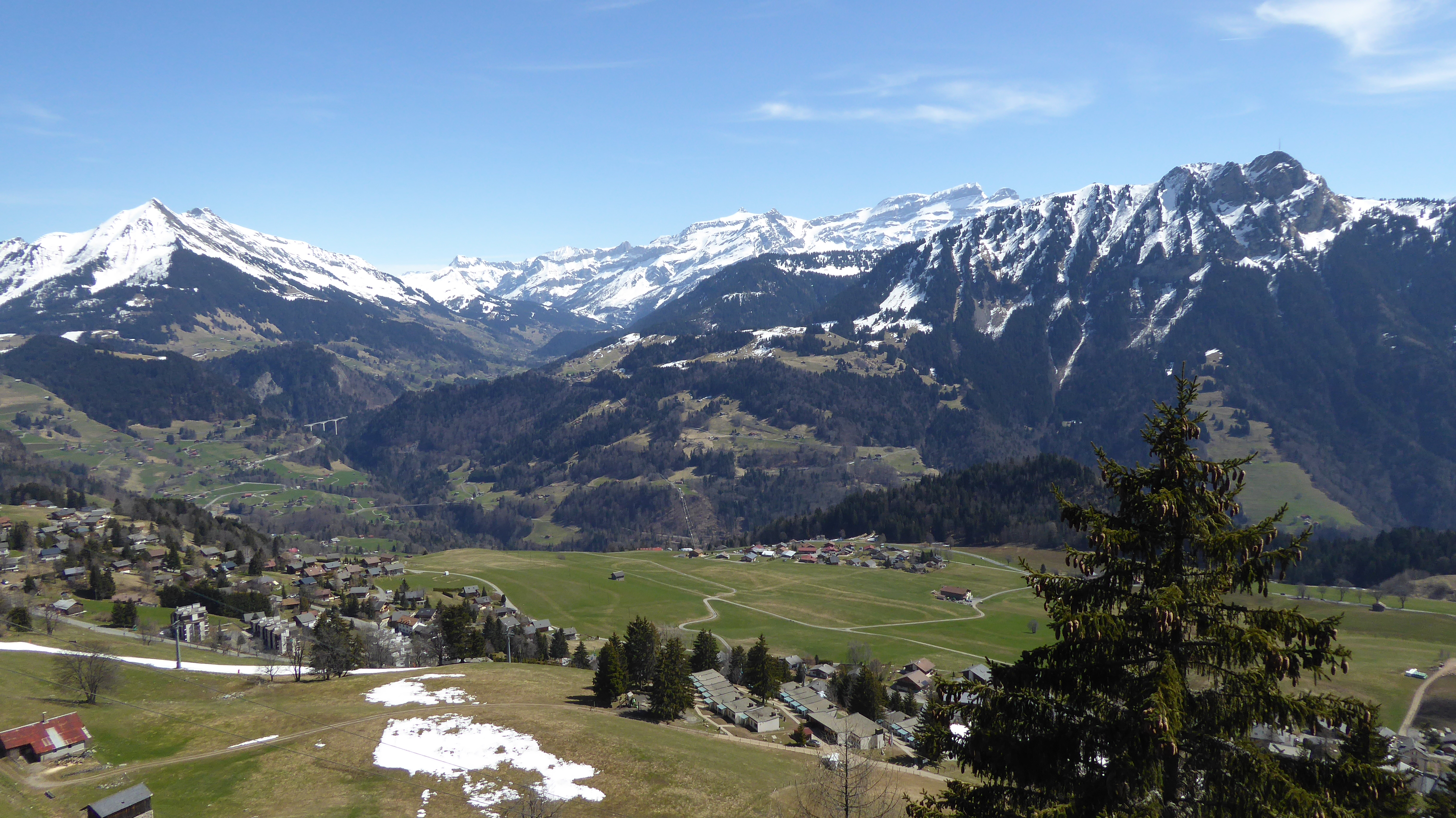
Nice View of the Alps from the Tour D’Aï

Tour D’aï via ferrata is a nice option if you are looking for a view of the Alps and of the Lac Léman region. You can take the telecabine from Leysin to the top and from here walk one hour and get to the base of the Via Ferrata de La Tour D’Aï. This is a challenging via ferrata if you are not accustomed to heights. What makes the views so enjoyable is also what makes the via ferrata itself so daunting.

Mountain biking down a via ferrata

VIA FERRATA from Summitride on Vimeo. Of course riding a mountain bike down a via ferrata is impossible. What is possible is riding the bike at the start and end of a via ferrata. In this video we see an individual ride down some routes where we would not feel at ease with full safety gear.

What is Via Ferrata

[caption id=“attachment_2216” align=“aligncenter” width=“660”]The landscape visible from the Plan Praz Via Ferrata. The landscape visible from the Plan Praz Via Ferrata.[/caption]

Rock Climbing For Tourists

Via Ferrata (VF) is rock climbing for tourists. It is a method by which non rock climbers can ascend a cliff with a minimum of training and effort. Hand holds and foot holds are placed within easy reach of these others. Participants in this activity benefit from a new perspective on the landscape and learn to handle their fear of heights and move at the group’s rate rather than their own.

TomTom Go and the diminishing cost of live traffic data when driving

Today with Tomtom Go you pay 20CHF per year for the maps and traffic information. When I first bought the TomTom Europe apps for iOS and Android they cost about 170CHF an operating system. If my memory serves me well traffic information would cost an additional 100 CHF per year. As a result of the high cost for traffic information I was in the habit of using Waze. As long as you have a data connection you get maps and traffic information for free. It would save you 270 CHF initially. When you live in the french speaking part of Switzerland you are just minutes from France and within hours you can be in Germany, Austria and Italy. As a result having maps pre-loaded in to your navigation is useful. That’s where Tomtom at 20CHF per year becomes interesting. The maps available are for individual countries, for Western, Europe, Eastern Europe, the whole of Europe, The Caribbean, North America and South America. Each of these maps can be downloaded ahead of a trip and used. This means that once you’ve paid your 20 CHF you have maps for the world, not just for your daily commute. I am so convinced by Tomtom’s new philosophy that I have uninstalled Waze and will now use Tomtom primarily and Google maps as a backup.

Amersports and Sports tracker

Today Amer Sports announced that it has bought Sports tracker. Sports Tracker is an application that I have been using since I had the Nokia N95 8GB. I used it on symbian, iOS and Android devices over the years. What I love about this app is the way it displays information about the work out. It gives you several screens while you are exercising with the option to select which information you want to see most. [gallery columns=“2” ids=“2305,2306”] Once you arrive home and synchronise the workout with the web interface you can see the information displayed above. You can choose whether there is a topographic map, a normal map or satellite imagery. It is simple and intuitive to read. Suunto make devices that I like using. I have used the Suunto D9 diving computer, the Suunto D4i diving computer, the Suunto Ambit 2 and the Suunto Ambit3. Suunto dive computers are small diving computers that you can wear in day to day life. When you are passionate about diving this is nice. The Suunto Ambit family are more interesting for people who do land based sports. I used the Suunto Ambit 2 and 3 when doing via ferrata, hiking, cycling and other sports. The advantage of these fitness watches is that they have long battery life. This means that you can be active for two or three days before worrying about the battery dying. In this respect they are far better than mobile phones for fitness activity tracking. Suunto products and Sports tracker do not communicate natively. Suunto products synchronise with movescount. From movescount you need to export the GPX workout files and import them to Sports tracker. I would like to see Suunto devices communicate directly with Sports tracker. In my eyes the best option would have been for Sports tracker to buy movescount and for them to take over the web interface for Suunto. They both provide interesting web interfaces and combining the two would have been mutually beneficial. Time will show whether Amer Sports with links to sports tracker, precor and Suunto will come out with an interesting amalgamation of the three products/services. I look forward to finding out.